Remote Sensing Cross-Domain Scene Classification: A Dataset and Benchmark
Introduction:
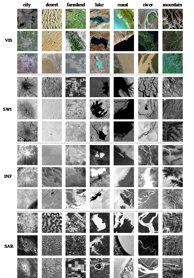
The Multi-modal Remote Sensing Scene Classification Dataset (MRSSC2.0) is a cross domain remote sensing scene classification dataset with four modes of Visible Near Infrared(VIS), Short Wavelength Infrared(SWI), Thermal Infrared(INF) and Synthetic Aperture Radar(SAR), which is constructed based on the high-quality earth observation data obtained by Tiangong-2 Wide-band Imaging Spectrometer and Interferometric Imaging Radar Altimeter. The dataset contains 26710 images of 7 typical scenes including city, farmland, mountain, desert, coast, lake and river. In addition, MRSSC2.0 provides an extended task: weakly supervised cross domain target detection. MRSSC2.0 will promote the development of cross domain remote sensing scene classification and stimulate innovative research in weak surveillance target detection and domain adaptive data retrieval.
Sample Images:
Downloads:
Baidu netdisk:
https://pan.baidu.com/s/1WFxqBlnxsQa0ddS6V3ESbQ (password: m64g)
Google drive:
https://drive.google.com/drive/folders/1p5oAVuWqyf81I03Ue1m7NyM7P7vrLDZn?usp=sharing
Publications:
Liu K, Yang J, Li S. Remote-Sensing Cross-Domain Scene Classification: A Dataset and Benchmark[J]. Remote Sensing, 2022, 14(18): 4635.
附件下载:

 010-82178817
 所长信箱:csu@csu.ac.cn
 纪检信箱:jijian@csu.ac.cn举报电话:010-82178815
 010-82581990
 北京市海淀区邓庄南路9号 (邮编:100094)
